subduedtuna
2025-07-25 01:39
Are they truly unsupervised testing vehicles? I thought they were mapping the service area for the future - as Tesla is doing everything they can to avoid relying on radar
But yes, those have been all over Palo Alto and nearby
Lovevas
2025-07-25 01:44
I don't recall seeing many of such cars before this year, but it came out a lot this year, particularly after robotaxi launch, so I assume it's more likely related to Robotaxi?
ChunkyThePotato
2025-07-25 01:46
Nobody knows what they're doing, honestly. But it seems unlikely that they're constructing maps that will be fed as input to the FSD net. FSD is built to work with basic maps as input, and the Robotaxi cars don't use lidar, so there's no way they can try to match the pre-made scan to a live scan.
psychoacer
2025-07-25 01:53
How did the chargers get connected if they're not supervised?
Whaleflex08
2025-07-25 01:57
A launch edition tho?
subduedtuna
2025-07-25 01:59
I’m saying it’s scouting vehicles to set the service maps for robotaxis
It totally could be them testing radar/lidar etc, but I really doubt that is the case
subduedtuna
2025-07-25 02:00
But couldn’t a radar scan of a robotaxi service area potentially improve the behavior of fsd/robotaxi within that area? That’s my prediction for the use. It would be shock if the flipped their stance on use of radar/lidar
Green-Jacket1217
2025-07-25 02:02
Would love to see robotaxi with lidar sensor … safety first
ChunkyThePotato
2025-07-25 02:04
How so? The actual Robotaxi cars don't have radar/lidar. So how would a radar/lidar scan benefit them?
Egineer
2025-07-25 02:05
No idea what they are doing, but that’s a setup I’d do for data collection for pose using something like a lidar.
subduedtuna
2025-07-25 02:11
By mapping the area, which then will feed map data to the robotaxis for use in the future
They can develop their own “street view” with the radar data - and use that data to sync with the data the fsd is seeing in their cameras
I also could be completely wrong, just a theory. As it would be more surprising to me if they switch to relying on radar/lidar for all fsd (which they should do but that’s a separate discussion
ChunkyThePotato
2025-07-25 02:14
Seems pointless. What benefit would feeding that scan into FSD provide?
And no, they should not switch. That's silly.
subduedtuna
2025-07-25 02:18
Because it’s clear they can’t launch robotaxi everywhere. So they need to create service areas, just like Waymo.
The benefit is using these vehicles to enhance their data of the service area for their robotaxis, to minimize potential errors etc when they roll out. The scan would provide FSD with a “backdrop” of radar data on the road - again speculation. As we both agree they won’t switch to radar, so it’s “weird” to see these vehicles
ChunkyThePotato
2025-07-25 02:23
No, but how would that benefit FSD? Like how would it affect its driving performance? Be specific. I assume you mean feeding in the scan as one of the inputs of the net. But the cars don't have radar/lidar, so they can't feed such a scan as an input to the net. It's physically impossible. So I really don't understand what you're saying. Do you know what the software architecture is here? It seems like you don't.
[deleted]
2025-07-25 02:33
Thanks for sharing, where in the Bay Area is this?
subduedtuna
2025-07-25 02:38
How could you say it’s physically impossible? A radar scan of an area can absolutely provide data that would be usable for any sort of mapping technology.
Anyways appreciate the convo, I am done here. Just sharing my thoughts and speculation
ChunkyThePotato
2025-07-25 02:40
It's physically impossible because the Robotaxi cars themselves don't have a radar. So how could they feed a live radar scan into the net to do inference with? I really don't think you understand the mechanics of the software here.
Shmoe
2025-07-25 02:59
FSD most certainly uses HD maps when available.
ChunkyThePotato
2025-07-25 03:00
It doesn't.
Zebraitis
2025-07-25 03:10
That's a bold move, Cotton... Let's see how well they do in a parking structure.
tonydtonyd
2025-07-25 03:24
It definitely is using higher fidelity maps than traditional FSD.
Ren_Lol
2025-07-25 03:29
The vehicle are actually using Radar/LiDar to validate the camera based software.
They’ve been using these since legacy Model 3/Y.
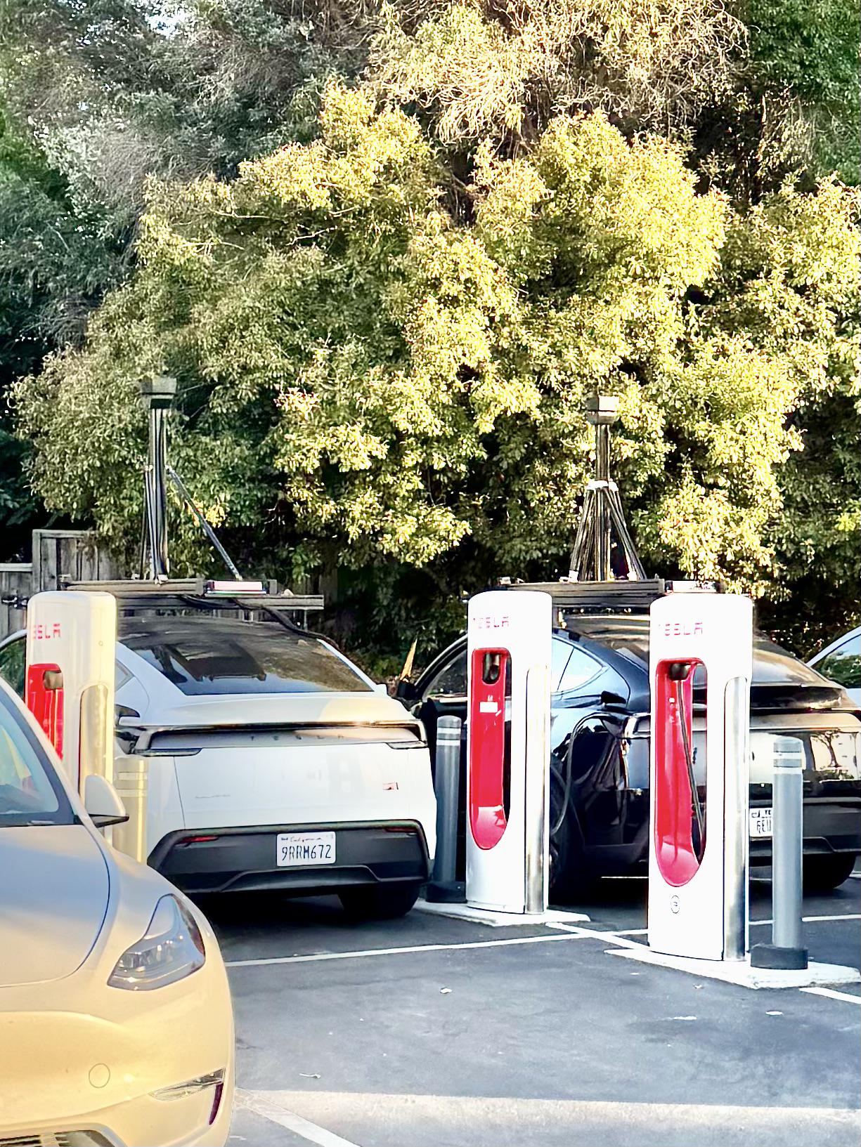
These are commonly spotted between Palo Alto and Fremont.
almosttan
2025-07-25 04:14
The only real answer in this thread.
kenspi
2025-07-25 04:44
Saw one (legacy Y) like these in Napa a few weeks ago.
danfoofoo
2025-07-25 04:51
> These are commonly spotted between Palo Alto and Fremont.
On Dumbarton bridge?
Terron1965
2025-07-25 05:39
They are validating that the Google maps they use for navigation match reality. Google maps are great but its their company thats reponsible if somehting is off. Google might also use some fake data to catch people using its maps. The Thomas guide used to do that years ago.
ChunkyThePotato
2025-07-25 05:40
You made that up.
MutableLambda
2025-07-25 06:36
FSD is trained in a simulator, maybe they map the area for their simulator. And after they train on that area it will benefit FSD.
Plus, maybe they're experimenting with FSD having access to highly detailed maps of the region, just to have another source of data. Then you'll be able to accurately pinpoint the position to, say, get real time updates from cars. So like your car matches the 3D scene it reconstructed and GPS location, with a 3D scene it expects. If they differ, it might flag the region for updating, or even, if you have a highly detailed map on your mothership server, it's easier to solicit updates from non-LIDAR cars and merge them with your highly detailed 3D map. Updating the mapis easier once you have it, and LIDAR is perfect for it.
MutableLambda
2025-07-25 06:39
Unless you're a Tesla employee (and even then) you cannot say with certainty what they do and they don't. The cybertaxis for sure have their own branch, no way to tell what they are experimenting with.
lamalamapusspuss
2025-07-25 09:07
Just yesterday Google Maps directed my to continue straight through an intersection in a very odd way: take the right turn ramp, turn left to drive perpendicular across the intersecting road, then turn left into that road's right turn ramp. As it happened I had a red light at the intersection, so following Google Maps' direction would have been a really bad idea. So, yeah, validating is a good idea.
LurkerWithAnAccount
2025-07-25 13:26
Yes, they’ve been using various rigs LIKE THIS over the years, but this particular “lightning rod” incarnation has been the one most frequently used and with the new Model Y over the last several months in areas where they are deploying Robotaxi.
In other words, this strongly suggests they are following up on what they reported in the most recent 2Q conference call that they’re expecting to deploy Robotaxi in San Francisco “soon” albeit with a safety driver behind the wheel (unlike Austin) due to the local regs and requirements.
stevew14
2025-07-25 14:09
So does this usually mean a new version of FSD is imminent? A point version or full version number?
GOA_AMD65
2025-07-25 14:50
They drive to NJ and wait on the gas station attendant to plug it in.
Icy-Swordfish-
2025-07-25 15:16
How do robo taxis charge I don't think the snake was finished
mailboy11
2025-07-25 16:29
Won't go inside
Magnus_Tesshu
2025-07-25 17:52
Or even an internal version... I don't know if it really means all that much
Magnus_Tesshu
2025-07-25 17:53
No idea what you meant, but these were spotted around Austin before robotaxi launch and also I think similar before they released v13
Egineer
2025-07-25 17:58
Then I was probably correct. They were mapping the driving areas for the robotaxi service with lidar, making a 3D map.
PeteDub
2025-07-25 18:35
8/10 chance they get trashed. Don't go to east oakland!
Luxkeiwoker
2025-07-25 20:03
\*unsupervised with a safety observer in the driver seat. You can't make this stuff up....
Shmoe
2025-07-25 20:25
And those mapping cars in Austin aren’t just validating things. They’re mapping the city in HD.
SubprimeOptimus
2025-07-26 12:40
I actually find this bearish
Theyre really going to have to do this for every new area?
What happened to the flip of the switch?
bking
2025-07-26 14:40
I’ve seen these around, always driving parallel to each other on the furthest possible lanes of their road.
It’s some kind of ground-truthing for sure, but the thing where they work in formation is new.
PhilosophyCorrect279
2025-07-26 15:46
Yup, this.
There was a Tesla engineer somewhere around here on Reddit that was just reading who explained a lot about this.
Everyone is calling out these Lidar units saying the camera only system won't work. He explained that in order to test, verify, and validate something correctly, is to use a different method to backup that data. Which makes sense, like you can use your hands to tell if your food is hot, but using a thermometer to confirm that is a good idea.
The cameras can see and work well alongside the AI, but it also doesn't mean much if the data is off, so using something else to ensure it's working is needed.
Personally I'm on the fence. Lidar and radar is better as it can "see better" than vision alone. But humans have only two eyes and have been driving for a long time. So in theory, it should be possible to have a vision based system, especially with 8+ eyes/cameras. Now to what extent, well that's the real question.
I have no doubt it's possible eventually, but practicality is another side.
danhoyle
2025-07-26 19:15
Think these guys are more data gathering vehicles.
TooMuchTaurine
2025-07-28 18:22
Lidar and radar can definitely not "see better" that eyes/cameras. Lidar and radar can't see lines, they can't read signs.. they are very limited in reality against cameras.
TooMuchTaurine
2025-07-28 18:27
We know what they are using it for, we don't have to guess. They are using it for ground truthing the video / AI vision data.. They basically drive around comparing the spacial data that comes out of fsd computer with the lidar data they get from these rigs. They drive around an then look for anomalies where the lidar and camera based system didn't agree. Those locations are flagged to the fsd team for review. If it turns out there is a legitimate discrepancy the labelled video data from the cameras where the camera got it wrong, the videos are sent to the training team to fine tune the model.
There is an extremely detailed breakdown of it all in this article
https://x.com/pbeisel/status/1947650440663077092?s=09
PhilosophyCorrect279
2025-07-28 18:48
Yeah my bad, that wasn't the best way to say what I was thinking.
They can "see" "more physically" ? Like they they are actually measuring the size, and distance of things vs. vision that can only sort of guesstimate the same data. Lidar is more precise, and along with radar, can ignore some outside elements like rain or sunlight with much more ease than cameras can.
SC_TheBursar
2025-07-28 22:57
Can rephrase that as local licensing requirements. Which they would/must apply for if they want to go to driverless or safety observer (passenger seat) operations.
Licenses they have not even applied for yet. Essentially these are going to be operated in the same regulatory regime as ... well ... a regular (non-robo) taxi. Basically an Uber driver chronically using FSD.
TooMuchTaurine
2025-07-28 23:49
Lidar still gets pretty disrupted by rain and thick fog.. radar is not so accurate or high fidelity.
I would argue being cm accurate is not that important for driving.. we do it easily without being able to judge cm's
Internal-Delusions01
2025-08-07 00:57
Saw them today cruising down 880
MyMacGuru
2025-08-25 21:26
The crux is latency. Tesla removed radar to make the cars safer. For example what does the car do when radar/lidar have different data than Camera? Which one does it choose. Having Lidar is actually more dangerous. This is why Waymo vehicles are not allowed on the freeway